Thursday, September 27, 2012

Seattle/Seabeck/San Juan Islands

Pulling the mast
Replacing transducers

Hood Canal Bridge - coming and leaving
Pleasant Harbor and the Cole's place across the canal
9/27 - Friday Harbor

I’m sitting here in Friday Harbor writing this blog. Except for one day, it’s been sunny and warm since I left Seattle, and in Seattle it was perfect weather too.  I can’t believe how nice this weather has been.  The people here in the North West can’t believe it either...lots of fires are becoming an increasing danger here on San Juan Island. They had a nasty fire on the west side, but was put out pretty quick. It’s funny when I look at the weather report in Ketchikan, rain, rain - here in Washington, sunny, sunny.


Blue Bossa in front of the Cole's house (to the left)
Party at the Cole's!
Blue Bossa from the Cole's house
Bill's Magic BBQ touch
I hope that the weather stays like this for the next 10 or so days, as my son Alex will be here tomorrow and the next day we leave to head south to California, about an 850 mile trip. There are lots of opportunities for winter weather to try to show its hand, since Fall is trying to bust in, but so far only showing shorter days and cooler nights. I don’t relish pounding into a rainy south-easterly on my way down.

Friday Harbor is pretty much how I left it a year and a half ago. Some shops have changed, dock fees have gone up, but otherwise same ol’. I’ve been in touch with some of the musicians and have sat in on a San Juan Quintet gig at Rumor Mill, and practiced and played with the big band “One More Time”, and will play tomorrow night at the Rumor Mill with them.  Playing in a big band is a remarkably disciplined feat: as one of the members mentioned: playing in a big band is like driving a locomotive on a railroad track vrs driving a sports car on the salt flats which is akin to me playing in a piano trio.

Last month, I finished up getting the boat overhauled with the help of Yacht Masters. I mentioned in my last blog what I did to the boat.  I’m still in sticker shock and will likely stay that way for the rest of the year. The boat performs very well, though I have still to try out my new solent jib. The auto pilot is super quiet and steers as straight as an arrow (my old autopilot was nicknamed “Snake-Way Sam”) and takes less electricity. The Simrad system works really well and is nicely user intuitive. Radar is super clear - fog is much less stressful.


Bill & Cathy - Bill was the ferry operator
Matthiew (on the right) and friend
Cathy & Bill
Cathy & the Captain
 September found me leaving Seattle and heading to Pleasant Harbor, located in the Hood Canal. The Hood Canal bridge is an obstacle that was interesting to pass through. The highest part of the bridge (east side) is 52’, and that’s almost exactly what my mast height is. Luckily it was a minus tide, so I backed up slowly, watching the top of my mast and made it clear enough.  But I decided when I went out, that I would call the bridge and have them open the gates for me (it’s a floating bridge in the middle of the canal), which meant that I would have to get them an hour to comply, since the operators have to drive from an office to work the bridge.

I checked into Pleasant Harbor, which is, indeed, pleasant. It’s basically a resort, with swimming pool, little pizza store, and some other cool things.

The next day, I went across the canal to tie up in front of my friends Bill, Cathy and Matthew Coles’ house.  They had finished remodeling (aka: teardown) their home overlooking the canal and the Olympic Mountains a couple of years ago.  I don’t think you could get a more scenic


Hood Canal Bridge letting me out
A kayak crasher
New electronics


Sucia Island
On one of the Sucia islands


Interesting sandstone
view from any house that I know. They put a lot of time, energy and money into their home and it shows. Their next door neighbor had a bullet-proof mooring buoy on the canal, which I was able to use, going back and forward using the dinghy (without engine), and then using his clothesline rig that he had set-up.

The two nights I spent there was a great visit, with a fun dinner party first night with some of their friends, then we had a nice sail on Blue Bossa the next day, with another fine dinner afterwards on Labor Day. The sail was especially nice because we actually had a good wind, so sailing with main and 150 jib was a lot of fun. Mathiew, Bill and Kathy’s son, brought a friend along and both had a great time exploring the boat and enjoying the sail.

Tuesday after Labor Day, I sailed through the hood canal, timing the tidal currents nicely, and arriving at Friday Harbor at almost nightfall.  For the next 3 weeks, I revisited some of the places I’ve been before (South Bay/San Juan Isl, Roche Harbor, Reid Harbor on Stuart Island, Anacortes).

A couple of places were new that I visited. Just south of Anacortes is a place called Skyline Marina in Flounder Bay, a mostly retired community with a goodly amount of boats in a land-locked marina.  I had my Yanmar serviced there. The other first-time place was Sucia Island. Sucia Island is a unique horse-shoe shaped set of islands that is a full-on state park, much like Stuart Island This was a full-on park, with mooring buoys ($12/nite), lots of clearly marked and kept-up paths which I explored. I stayed there 3 nights.

During this whole time, I never once used my dinghy.  I was always using the kayak, since the weather was nice the whole time, even if the water was at a cool 51 degrees. One very quiet night while I was reading a book in bed, I heard a noise that I couldn’t identify towards the stern of the boat. I got up, had the flashlight and pointed it to the stern of the boat.  The noise sounded like it was outside, so I looked over the stern and saw a seal perched comfortably on top of my kayak, which was tied up to the stern of Blue Bossa.  I just had to take a picture. When I got up in the morning, the seal was gone.

The first part of September was unbelievably crowded with boats, but has been getting less so as the month has gone by. The first time I was here, I was lucky to get a slip, and worked diligently not to run into any other boats. There were also a lot more shops open during this time than what I remember from the winter spent here, especially ice cream shops.

So - stay tuned for my last adventure with Alex going down the west coast of Washington, Oregon and California. After that, I’ll be staying somewhere in central California (probably Half-Moon Bay) for probably a year.  Depending on what happens during that time will determine when I take the boat further south, with continuing Blue Bossa Blogs.


Monday, August 13, 2012

Where have I been these last two years?

This chart is to show you where I've visited the last 2 plus years. The northwest is so beautiful with so many places to explore.  Despite all of the labels you see on this chart (most of them are overlapping other labels to as much as 3-4 layers, so you can't see all of them), I still only scratched the surface in exploring.  If it wasn't for the fact that the northwest is mostly cold and wet, I would stay up here forever (or until I die, whichever comes first).

But since I've been wanting to swim in warmer waters, and get more sunshine, I'm heading south.


South West Coast Vancouver Island to Seattle

Westview Marina to Seattle
Heading south on Tahsis Inlet
Well, I'm back in Seattle after 2 years of cruising around in the NW. I'm parked at a place called Yacht Masters, which is a company that is doing some work on Blue Bossa, which needed a bunch of work to keep it going strong.  Part of that is pulling the mast, change all of the standing rigging, put in a solent jib (removable staysail for windier times), update my electronics which have started to falling apart, and change my very tired head (toilet), which has been a challenge because of the space limitations.

Friendly Cove - Uchuck III approaching
Uchuck III - backpacks and camping gear are on the wharf
Yesterday, on a Friday, I was invited by the Yacht Masters crew to join their group on an outing to watch the Blue Angels practice over Lake Washington.  They were able to borrow a 68' mega-yacht powerboat with all of the comforts and gadgets that you can imagine with a fuel consumption of 40 gal/hour.  The mega yacht was joined by about a kajillion other boats by the south end of Lake Washington, all converging from a million marinas and launch ramps, all partying down with a myriad forms of music blaring out on speakers.  Since the temp was about 90, there were all kinds of bathing-suit dressed people, drinking all kinds of alcohol.  Our group was a sober bunch, the skipper of the boat working hard to avoid hitting all of the other boats around.  He was naturally worried because he didn't want to scratch his client's VERY shiny and clean boat, so he was busy working the two diesels and all of the thrusters on the boat to avoid any connection to the boats.  And to think that the Blue Angels flying these unbelievably fast jet planes at supersonic speeds with only a few feet between them were just practicing for the main event, which was Saturday and Sunday.  The crowd on the lakes today will be a small gathering compared to what's coming.  I couldn't picture me bringing Blue Bossa in that mess.

Church - turned into museum
So the day was really fun EXCEPT for the fact that, while I was adjusting to using my new G4 iPhone as a camera, I accidentally dropped it overboard.  When I realized what I did, I yelled: "GOD….bless."  Now I have to wait a few days to get another phone (I was insured, but the insurance company for AT&T has to send the phone, AND, it still costs $200 deductible. I'm not sure insurance is worth it.)  Dumb.  I'm wondering if it's smart to have a smart phone, since  this is the 2nd one that I have lost in as many weeks.  Ugh!

Living on Lake Union brings back some old memories, not the least being that it's noisy in a city environment.  Thankfully I'm only going to be here through August or less, then I'm out of here. But one thing I like here is the great jazz station that also plays NPR.  Not only do I get great music, but i can stay up to date with news. Before I leave, I'm going to have to visit 1 or 2 jazz clubs.

Inside the "church"
Looking down from the lighthouse


Last I wrote, it was in the Westview Marina in Tahsis Inlet. After thoroughly spoiling myself on showers and good company from the various yachts visiting, I left to head south, working my way down Tahsis Inlet, then a right into Princesa Channel, then a left to Kendrik Inlet which works into Nootka Sound, where I anchored in Friendly Cove, a small Indian village called Yuquot ("Place of Many Winds") right on the north base of the notorious Estevan Point.  One of the boats that I met in Westview came down to Friendly Cove too.  On board was a Brit and his Irish wife who have been living in Vancouver for the last 20 something years, but he still had a very British accent.  He mentioned that the village had a small fee ($12) for visitors to go ashore, and thought it was outrageous and he wasn't going to visit - I could sense of hint of racism in his statement. I thought, what the hell!, why not donate to the cause?  So I went to shore, just after the coastal freighter MV Uchuck III  had stopped to let off passengers and some supplies off.  This small freighter stops by many villages along the west coast of Vancouver Island during the summertime, dropping off hikers, kayakers, residents, and food to many isolated places that cannot get supplies by any other means.  I always wonder what happens during the winter times.
I took that picture?? Friendly Cove

After getting on the wharf from a nearby float, I checked out the Uchuck (also known as "Upchuck" to many of the passengers), I ventured into the interior, climbing up a low hill until I reached a church (there were a few tourists doing the same from the Uchuck). After paying the $12 fee at the side office of the church, I took a look at the church itself - it almost seemed "pagen", because instead of having anything symbolizing Christianity, it displayed colorful totems and other art made from the village of Yuquot, as well as some interesting stained glass windows depicting some history in the past.  I guess you could call the building more of a museum.  The benches instead of facing the alter, were divided, one set facing the other.

Reefed main and jib - starboard tack
The terrain outside was really beautiful, sunshiny with wide open fields, surf and strong westerly on the outside of the bay, and a very scenic Nootka Lighthouse standing on the rocks of Yuquot Point. It took me a while to find the path that leads up to the lighthouse, and once there, the lighthouse keeper and his wife were very friendly, used to showing off their lighthouse with many summer tourists that come to visit.

Buddy boat
The forecast was for gale force north-westerly for the next 5 days, so I decided to head south anyway around Estevan, which is a low-lying point that stays shallow 2-3 miles out. The wind can really rip through there. The couple that I met wanted to go too, and we decided to "buddy-boat" around the point.  Which is what we did, leaving at 6 am.  I thought it would be calm that early, but as soon as we got out a couple of miles, the wind started getting stronger and the waves got bigger.  I had my main and jib reefed and had a ton of control.  In retrospect, I could have sailed around the point easily with the jib all the way out.  Unfortunately, the autopilot just wasn't able to keep up with the heavier seas (I've seen indication to that a couple of other times in the past), so I generally had to steer most of the time, which was ok because it was fun to try and surf some of the waves.  Once it was time for the jibe, the buddy boat called me via VHF and asked me how I was going to do it. I decided to do a chicken jibe with the motor on, which I did with no problems. Once on the proper course, we split up.  They went to Hesquiat Harbour and I went to Hot Springs Cove.

The hotsprings and falls are left and to the right of the tourists
Board walk with carved boards of boat names


Steam from the HOT waterfall


Hot Spring Cove is a very well protected long cove. I ended anchoring close to the head of it, which is about a half mile from the main park on the south side.  The north side has a small Indian village.  The park is famous for it's geothermal spring with a strong and VERY HOT waterfall which lies very close to the entrance to the bay. The day I arrived, I took the dinghy to the entrance and took some pics of a dozen or so tourists lazing on the rocks after a good hot soak. During the summer, there are a lot of tour boats that take tourists from Tofino out to this place, and it can get really crowded.  There's not a lot of room in the series of rock pools positioned to receive the hot water that pushes through it.  I decided to try it first thing in the morning.  So to the wharf, then walking west about a mile of boardwalk, many of the boards carved with boat names, apparently a long tradition of boaters. I got there with the first load of tourists, most of them young (like in their 20's). Ho boy!  As I was the first to get in, I slowly but surely migrated to the very end of the series of pools, while the place started to fill up.  I had a very lovely conversation with a young German woman who lives in New Zealand. I asked her what New Zealand is like, and she said it's very much like here. Well gee, I guess I don't need to visit New Zealand after all!


The next day, I headed out, outside of Tofino (which, after talking to a lot of boaters, elected not to stop there) and ended up in a little but crowded fishing village called Ucluelet. It is sort of the civilized boating center for all boats cruising Barkley Sound which lies just to the south. Barkley Sound is a destination spot for many Canadians boat owners as well as boaters from Washington and Oregon, whom I met a few.  The dock master was super friendly in a gruff sort of way, and went out of his way to make sure I was docked right. I was able to go to a small supermarket and catch up on some emails. 

After two nights of Ucluelet, I left to go to my jumping off spot to enter the Juan De Fuca straits. Diving into Barclay Sound and the "Broken Group" of islands was interesting - it wasn't as crowded as the San Juan Islands, but it had a lot more boats than I normally saw in Vancouver Island. There is a ton of great anchorages to be had in all of the islands there. I could have spent at least a couple of weeks visiting each anchorage.  But instead I stopped by for lunch at a place called Joe's Bay Anchorage, which was a really nice spot to kayak (there were at least 3 separate kayak tours going on - pretty busy).  It looked like I was the only one anchored there, although there was a number of yachts going through and checking it out. I ended up staying the night at Dodger Channel, where I spent the evening paddling the paddle board to shore and walking around enjoying the solitude.  Only one other small fishing boat anchored that night.

Dodger Channel - Cape Beal in the background
The next morning at 5 am, I left, rounded Cape Beale and proceeded to head up the Juan de Fuca Strait.  I stayed on the north side as close to shore as I could to avoid the worse part of the ebb current where it stayed pretty glassy.  When the tide finally started flooding at about 1 pm, I started to go across the strait to the US side, finally getting a good 2-3 knot current boosting my speed.  By the time I got to Port Angeles, the tidal current had almost run its course.  I barely made it to the docks on time to go through customs.

Back in the US of A.

This place is HUGE
Right now, the mast is off. It's been great getting a closeup of how the mast is put together.  It's in pretty good shape.  Here in Seattle, it's still hot (80 - 90 degrees, fans on, all hatches open, ports open). I'm starting to grasp the idea that having a dark-blue hull may not be a great idea in places like Mexico.  I'll have to figure out if I want to change the color or not.
Here's where I'm at now, Lake Union

Once I'm done here in Seattle, I'm heading to Friday Harbor to hang out a bit, then Alex will fly up to meet me near the end of September, then we'll scoot down the west coast to San Francisco before winter starts to show it's ugly head.  That should be an adventure!


Friday, July 13, 2012

West Coast Vancouver Island - North

West View Marina in Tahsis - a welcome bit of civilization

7/13/12

I'm sitting on my boat in a splendid little marina called West View Marina, near the community of Tahsis, 17 miles inland, as the crow flies, from the Pacific Ocean.  It's primarily a sports fishing marina with lodges, rentals of boats, kayaks, it has a nice bar and restaurant with a sort of Jimmy Buffet motif, amply emphasized by playing Radio Margaritaville in their PA system.  Near the bar is a series of filet tables with spray nozzles and sinks that the sports fisher can clean their catch. Per day here, it's $50, but it's worth it with clean showers, laundry, boat boys to help you dock your boat, electricity(!),and fresh water as well as fuel. It's got internet, but no cell phones. The couple who run the place keep it up very well and they "run a tight ship".

Approaching Tahsis
It helps to have a Jimmy Buffet motif when it's been so clear, hot and sunny.  I have all of my hatches open, windows open, there's a breeze from the south filtering in (supposedly there is a 40 knot NW gale on the coast). And all I have is a pair of trunks - no shorts!  How short sighted of me!  Did I tell you that it's been nice weather ever since I got to Vancouver Island.  I, at first, thought there was some sort of weather divide between Haida Gwaii and Vancouver, but, after I've talked to a few people, they said that the weather had been crappy here too. So who's to say that if I had stayed in Haida Gwaii for another week, I would have seen good weather there too.  It's like going on a surf trip to a special location, then for two weeks not having any swell, then leaving, and hearing afterwards that there was great surf the day after you left.  Ha Ha!  Oh well, best not to dwell on that too much.

Going across Queen Charlotte Sound, from Cape St. James on the south of Haida Gwaii to Cape Scout on the north tip of Vancouver Island, would be the longest single-handed trip that I've done yet during my intermittent career as a cruiser. For a crewed boat, the 140 miles would have been nothing as everyone stands watch for 3-4 hours at a time; but for me, by myself, in unknown waters with questionable weather, it would be a long day and night. Naturally, I was nervous and apprehensive, as I usually am on any long trip in unexplored situations. The same feeling I got in first crossing the Atlantic (both times), or racing from San Francisco to San Diego (3 times) on my ridiculously small yet excitingly fast 24 footer, with 3 other crew.

After saying my goodbyes to the denizens of Rose Harbour, we left about 10am and headed south along the most southern islands on the tip of South Moresby until we dived into the churning waters of Queen Charlotte Sound.  I left on a short weather window with a northwesterly, which came up stronger the further south we went, until eventually I had the motor off and we were speeding along at between 6 and 8 knots under sail.  However, instead of what I expected as clear skies, it was overcast and misty, visibility maybe a mile and a half.  About 10 miles south, a fishing boat suddenly appeared, its course intercepting with mine so that I had to change course to avoid crashing into it. It was trolling slowly upwind.

Queen Charlotte Sound was chaotic in its wave patterns - big, close-together, south swell, a west swell, and a northwest swell all at once made Blue Bossa jump, shiver, and dance in an awkward and half-hazard way, making me hold onto the handrails inside the cabin like an old monkey in a hurricane.  But it wasn't all that bad, and eventually, during the night, the seas piped down, as well as the northwest wind, and we eventually motored the rest of the way to Vancouver Island.  During the night (which lasted from 10:30pm to 5:00am) I would check my position to verify that I was on course, and hope that I wouldn't run into any logs, since I wouldn't be able to see them (luckily, ever since leaving Haida Gwaii, I hadn't spotted any logs at all, so i was hoping that my luck would hold). I would also check at designated times on the VHF radio buoy reports to find out the conditions in front of me.  It turned out that I needlessly worried, as the weather was fine during the whole trip. Nonetheless, the closer to dawn, the more I was yawning. It has been a long time since I did an all-nighter.
Sea Otter Cove

Finally, at about 9am, we ended up in Sea Otter Cove, a very secure anchorage on the northern tip of Vancouver Island.  It was a big cove and had 4 large mooring buoys in it, two of them occupied by a yacht and fishing boat.  I took the 3rd one, and, once the boat was shut down and secured, I headed for my bunk to crash for about 6 hours.  Hey, what can I say, I'm an old fart and need my sleep.  The rest of the day, I lazed around, enjoying the warmth and sunshine, which was a major environmental culture shock.

Next day we headed to Winter Harbor, a small settlement in the upper arm of Quatsino Sound.  At $1/foot, it was an expensive little place to tie up.  It had a fuel dock, but the fuel was expensive, and I decided, after not been close to a supermarket for a month, that I would only stay there for a night and head to Coal Harbour, a port deep in the interior of Vancouver Island much closer to civilization.  So we left the next day, trying to time it so that we could go through Quatsino Narrows which was the rather narrow and turbulent gate to Holbert Inlet where Coal Harbor was located.

Coal Harbour - doing laundry
I tied up to a assorted jumble of docks, where I was met by the Harbor Master, a portly, friendly Quatsino native.  He explained that the Quatsino tribe now had controlling interests to running the harbor.  During the winter time, it becomes a port of offloading for hundreds of sardine fishermen, who would catch a huge amount of sardines, pack them in ice and offload them in Coal Harbor. From there it would be trucked to the ferry in Nanaimo and end up in Vancouver to be processed. This represented a windfall for the marina, and they reinvested their dollars back into the marina with a new fuel dock, and nice bathroom and shower facilities. They still have a long ways to go for their docks, which are funky at best. 

In the meantime, it was raining with signs of it clearing soon.

Route in Quatsino Sound
I had a lot to do in the two days that I had planned to stay.  The first day (after the Canadian holiday weekend), I boarded on a bus at 9am to head to the east side of Port Hardy (which I had stopped by on my way north last year) so I could get a bunch of cash, and do some heavy grocery shopping, enough to last me for the rest of my NW journeys. Because of the heavy load, I opted to take a taxi back (Coal Harbour is only about 15 miles from Port Hardy). After that, I filled up on fuel, which cost a big chunk of change, as I had put on a lot of motoring time. The next day, I changed the oil and filter and general maintenance of the engine, took a shower, and then headed back to Winter Harbour.  I had forgotten that I was to pick up some mail that brother Rick and sent off weeks ago. However, there was no sign that the package had arrived, and having filled the boat with fresh water, I motored the short distance to Northern Inlet, where I spent the night. I motored back in my dinghy the next day to check the mail again, and no sign, so I instructed and payed the postmaster to send the package back to Rick's house.  Hopefully there was nothing in it important.
Columbia Cove

Columbia Cove


A local in Scow Bay
Another local - but different environmental medium
Just a pdf, trunks, hat and glasses


That afternoon, we upped the anchor and headed south, around the notorious Brooks Peninsula (West Vancouver's answer to Point Conception) with sunny skies, calm seas and wind, and headed east to Columbia Cove.  What a nice place!  The first thing I did was put on my bathing suit(!) and t-shirt and pulled my paddle board out and proceeded to explore kayak-style through all of the little places along the rocks (see the green line in the attached chart), but not before stopping by one of 2 other boats anchored there, a long and skinny Annapolis 44 in a distinctive green color called Osprey to introduce myself and wondering what the boat was - it reminded me of a Bounty II, designed by Pearson when fiberglass boats were first being built.  Steve and Elsie, the owners, later visited me on my boat, and we spent a nice hour chatting about our experiences.  They have been up the Vancouver Island west coast 25 times (!) and knew it like the back of their hands - in fact, Elsie, who is a fantastic photographer, wrote a couple of books, one of them called "Voyages to Windward - Sailing Adventures on Vancouver Island's West Coast".  As it happened, they had a couple of extra copies of that book on their boat, so I purchased one of them.  I'm finding it a fascinating read, as well as useful.

The next morning, the Osprey took advantage of a light southerly to get around Brooks Peninsula heading north, and Blue Bossa  headed south to Scow Bay, a dip in a series of islands called the Bunsby Islands.  I had the Scow Bay all to myself, so the first thing I did was launch my kayak (this time in just my trunks and a lifejacket, it was so warm - what a gift!) and explored the inner recesses of a big lagoon, as well as crossing Gay Passage to explore another island (see green route on Bunsby Island chart). Up in  the lagoon, I spied a ton of eagles, all sitting there looking regal and majestically swapping branches in the surrounding forest.  I also saw a lot of sea otters, which are beginning to grow in larger numbers.  The last time I saw sea otters was on Prince of Wales Island in Alaska.  It was good to see them again.  They're just so darn cute.

Another local - this time in Barter Bay
Busy Walter Cove
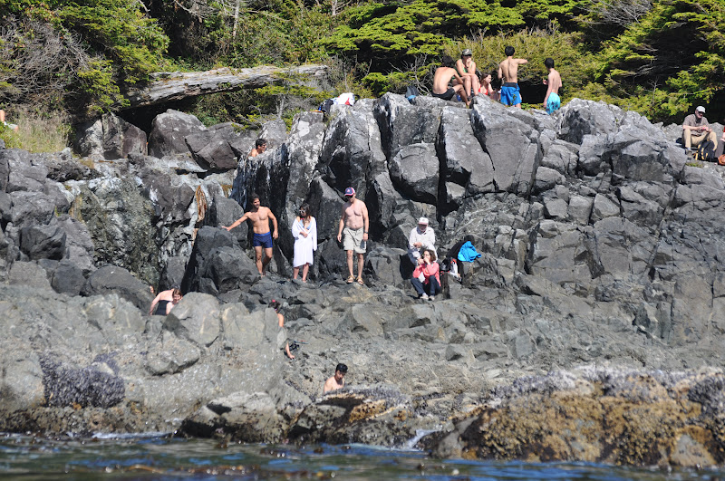
We left the next morning late to head south again.  We were merging into traffic in Gay Passage with a 40' Nordhaven trawler yacht - I let him go first.  I had thought he was going the same way I was going, but he turned into a bay on one of the Bunsby Islands called West Nook.  In it was another Nordhaven trawler (probably 60+ feet) which looked to be a kayak charter vessel (but turns out that it's not, just a giant boat to take a couple from one spot to another), as well as a small sailboat - with the 40' Nordhaven, it would be a pretty crowded anchorage. In general, I am surprised that there are so many yachts up here…I didn't figure on it to be a milk run like the east side of Vancouver Isl. But so far, I've had pretty good luck in not getting too crowded conditions to stay at.

We continued heading south, stopping by to scan out Barter Cove in the Mission Group of Islands, in case we had to anchor their that night, then continued east to Walter's Cove, which lies tucked in Walter Island. Walter's cove is a larger than normal, bustling and pleasant settlement of private houses and sports fishing lodges, filled to the brim with excited sports fishermen (oddly enough).  The dock that I tied up to was free (how about that?), and you could get around by way of a series of trails and boardwalks. A clearly marked trail lead me to the Walter Island beach where there were a bunch of driftwood (if in the water, they would be called deadheads) and some HUGE spruce trees. They had a little general store that carried more food products than I saw at Winter Harbour or Coal Harbour, and the lady there was very pleasant.


Entrance to Dixie Cove

The next morning, I left the already bustling cove to head inland to Dixie Cove, a narrow entrance and beautiful long cove with an inner cove, where I anchored there for the night. It would make a terrific hurricane hole, as it is relatively shallow, and is completely land-locked.  As beautiful as it was, there was nothing there to explore by kayak, so I mainly read and enjoyed the sunshine.  When I left the next day, there was a sailboat anchored in the outer cove.  That was nice of him to give me a little space.

Nuchatlitz
One of many cabins in Nuchatlitz


Oyster farm in Nuchatlitz


Two Nordhavens in Nuchatlitz - fog is in background
Strange places to kayak
 That day, I decided to make some tracks and head south. First we stopped at Blue Lips Cove, which was another pretty land locked anchorage.  I stayed there for an hour having breakfast and enjoying the scenery, then headed out Amai Inlet to Rugged Point Marine Park, where the two Nordhavens that I saw earlier were anchored, and after rounding Rugged Point, dived in-between land and a bunch of craggy rocks called Clear Passage (only if you avoid the rocks).  We eventually rounded into the next inlet called Esperanza Inlet, big fiords going in all directions. Not as majestic as Alaska fiords, but still very beautiful. At the south entrance of the inlet is a provincial park called Nuchatlitz, a series of low-lying islands all tied together by winding narrows.  At the peninsula end, there are a number of houses used either for vacation, or, in some cases, people living there all year round and harvesting oysters, as there were a number of oyster farms in the area. This place was meant for kayakers - and I took advantage and explored all over the place, both when I got there, and the next day. Of course it absolutely helped having another perfect day, sunny, slightly windy, a beautiful sunset, etc. I mostly had it to myself.  One of the house owners and his family came out to talk with me, interested in the boat design.  They are from Seattle who purchased a small house for vacations years back and spending a couple of months a year in it and using their aluminum skiff for fishing.  The guy used to commercial fish up and down the Vancouver Island west coast, so he knew where to catch fish and new all of the ins and outs of the area, even in heavy fog.  He even gave me some salmon the next day.  What a spectacular gift!

The next day, it was pea soup fog just breaking before Nuchatlitz.  I waited until late afternoon to (a)wait for the fog to burn off and (b)wait for the flood to run, so that I could have a nice sail up the channel towards Zeballos.  So during that time, I did some more kayaking, and visited the two Nordhavens that seem to be buddy-boating down the coast together.

Going up Esperanza Inlet


So going wing-on-wing to the east was very pleasant until I reached Zeballos, the wind following me almost all the way through the various turns to get up there.


Zeballos - BB rafted up to a commercial boat
Zeballos, however, is a run-down town, "frontier" in appearance, and nothing there of any substance except the beautiful scenery.  Worse, there's a sardine loading plant where the refrigerator generator was going 24/7, and the people were busy offloading sardines.  It was chaotic at best, but I managed to sleep through it, though I couldn't leave soon enough in the morning.


Route on the west coast of North Vancouver Island
From there, it was a short trip to Tahsis Inlet and then north to the Tahsis community. And here I sit at the Westview Marina, enjoying the beautiful weather and chatting with the various sailboat cruisers here.

My next blog will probably come out of either Victoria or Friday Harbor.  Until then, adios!