Charlotte City (really, a village)
 |
| Going down Felice Straits with a liner passing by |
I'm sitting in the "Queen B", a little artsy coffee shop with WiFi writing this short blog. Haida Guaii (Queen Charlotte Islands) is very interesting so far, and I hope to write you all a complete blog on it the next time I find a WiFi outlet - probably somewhere on Vancouver Island. Haida Guaii is definitely off the "milk run" of the typical cruiser. Only the most hardiest of boaters or fishermen come out here, especially on its west coast. Since I'm not the most hardiest of boaters, I've elected to stay on the east coast, partly because of the rough weather, but mostly so I wouldn't have to brave the treacherous and tricky narrows that separate Graham Island from Moresby Island, especially single handed.
 |
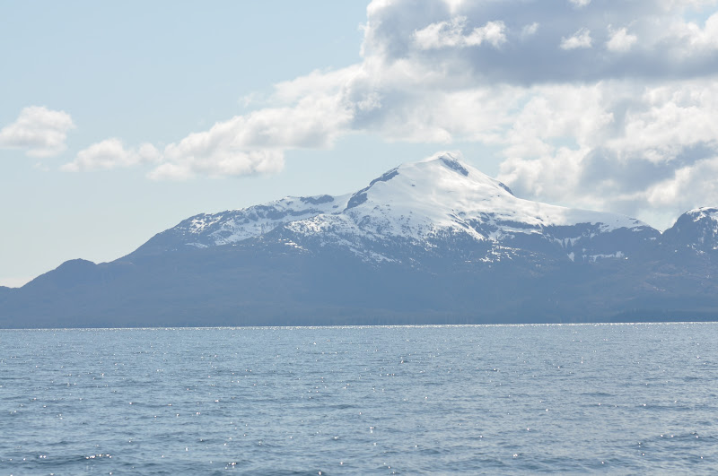
| Looking west at Annette Island with Dubuque Mountain |
After a week in Ketchikan,
Blue Bossa and I headed south through the Tongass Straits, diving into the Revillagigedo Channel until we hit Foggy Bay Cove. After a full week of nothing but rain, this trip south enjoyed a perfect, cloudless and sunny day. What a treat!
 |
| Looking west up Behm canal at the beautiful Mystic Fiordes |
Foggy Bay has an outer and inner place to anchor - I would have preferred the inner, but wanted to leave super early the next day, and it would have been too low-tide to get in and out. So I spent the night in the outer anchorage, which was a tricky place to anchor, being very deep and the boat being very close to shore. The wind was blowing slightly out of the northwest, so I was anchored on a lee shore, but there was no indication that the wind was going to increase. Nonetheless, I stayed up until almost midnight, and woke up about 3am. Not a lot of sleep. Interestingly enough, there's probably only about 4 hours of dark, the rest is light.
 |
| Foggy Bay at 10:30 pm |
 |
| Foggy Bay at 4:00 am |
At 4am, we upped the anchor and proceeded south to Prince Rupert, following the flood tidal current up through the narrows at Metlakatla Bay until we broke into Prince Rupert Harbour, where we spent the night at the PRYC. Because of poor weather and heavy winds, I opted to stay another couple of days in PR, but moved the boat down to a funkier and less expensive docks called Rushbrook Floats, where I rafted up to a classic wooden fishing boat. There were lots of different, junkier (blue collar) boats with very friendly people. It was also a launch ramp for lots of other boats that would come in. During the weekend, there was a couple of small powerboats rafted up with country music wafting out through the harbor and lots of alcohol intake with empty cans of beer on the docks. Most of the guys and gals were in their twenties, but there was one guy closer to my age that showed me around the harbor, introducing me to some characters. Of course the guy was drunk as hell, so I was a bit embarrassed for some of the people that we talked to.

The weather cleared and we headed out early, timing a strong ebb tide, heading south through some outside islands in Arthur Channel, until we hit the Ogden Channel which headed west until we got to Beaver Passage, pointing me to the open ocean. Before we got completely out, we hit Banks Island where we wriggled our way into Larsen Bay where we spent the night. Banks Island is a low-lying island, open but protected from westerlies (especially at high tide). During the day, I heard either dogs or wolves howling and barking on the island with no sight of them.
 |
| A mini-tree growing on some pilings at Rushbrook Floats |
|
After spending a quiet night, we left early to head across Hecate Straits to Haida Guaii. It was a mostly glassy crossing. What was really amazing was that I never saw a depth more than 200 feet. Apparently that's the reason that crossing these straits can be really dangerous, especially with strong winds going up against opposing tides.
After a long 45 mile crossing, then rounding the bar off of Graham Island, we headed south another 15 mies to Moresby Island (Sandspit), where I stayed for another 2 days waiting for good weather again.
So here is where I leave you all - I will complete a blog all about my travels in Haida Guaii, a place that I've wanted to explore for a long time.
 |
| From Ketchikan to Charlotte City |
|