Tuesday, June 12, 2012

Charlotte City (really, a village)

Going down Felice Straits with a liner passing by
I'm sitting in the "Queen B", a little artsy coffee shop with WiFi writing this short blog.  Haida Guaii (Queen Charlotte Islands) is very interesting so far, and I hope to write you all a complete blog on it the next time I find a WiFi outlet - probably somewhere on Vancouver Island.  Haida Guaii is definitely off the "milk run" of the typical cruiser.  Only the most hardiest of boaters or fishermen come out here, especially on its west coast.  Since I'm not the most hardiest of boaters, I've elected to stay on the east coast, partly because of the rough weather, but mostly so I wouldn't have to brave the treacherous and tricky narrows that separate Graham Island from Moresby Island, especially single handed.

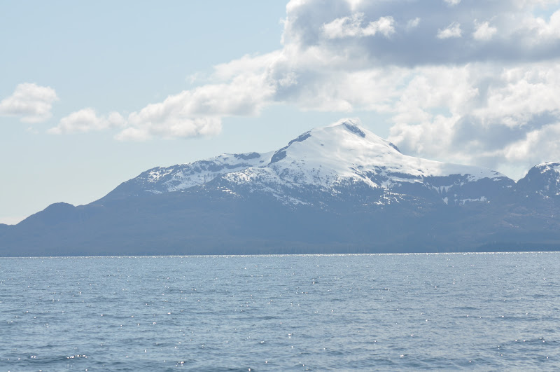
Looking west at Annette Island with Dubuque Mountain
After a week in Ketchikan, Blue Bossa and I headed south through the Tongass Straits, diving into the Revillagigedo Channel until we hit Foggy Bay Cove.  After a full week of nothing but rain, this trip south enjoyed a perfect, cloudless and sunny day. What a treat!

Looking west up Behm canal at the beautiful Mystic Fiordes
Foggy Bay has an outer and inner place to anchor - I would have preferred the inner, but wanted to leave super early the next day, and it would have been too low-tide to get in and out. So I spent the night in the outer anchorage, which was a tricky place to anchor, being very deep and the boat being very close to shore. The wind was blowing slightly out of the northwest, so I was anchored on a lee shore, but there was no indication that the wind was going to increase.  Nonetheless, I stayed up until almost midnight, and woke up about 3am. Not a lot of sleep.  Interestingly enough, there's probably only about 4 hours of dark, the rest is light.

Foggy Bay at 10:30 pm
Foggy Bay at 4:00 am
At 4am, we upped the anchor and proceeded south to Prince Rupert, following the flood tidal current up through the narrows at Metlakatla Bay until we broke into Prince Rupert Harbour, where we spent the night at the PRYC. Because of poor weather and heavy winds, I opted to stay another couple of days in PR, but moved the boat down to a funkier and less expensive docks called Rushbrook Floats, where I rafted up to a classic wooden fishing boat.  There were lots of different, junkier (blue collar) boats with very friendly people.  It was also a launch ramp for lots of other boats that would come in.  During the weekend, there was a couple of small powerboats rafted up with country music wafting out through the harbor and lots of alcohol intake with empty cans of beer on the docks.  Most of the guys and gals were in their twenties, but there was one guy closer to my age that showed me around the harbor, introducing me to some characters.  Of course the guy was drunk as hell, so I was a bit embarrassed for some of the people that we talked to.

The weather cleared and we headed out early, timing a strong ebb tide, heading south through some outside islands in Arthur Channel, until we hit the Ogden Channel which headed west until we got to Beaver Passage, pointing me to the open ocean.  Before we got completely out, we hit Banks Island where we wriggled our way into Larsen Bay where we spent the night.  Banks Island is a low-lying island, open but protected from westerlies (especially at high tide).  During the day, I heard either dogs or wolves howling and barking on the island with no sight of them. 

A mini-tree growing on some pilings at Rushbrook Floats
After spending a quiet night, we left early to head across Hecate Straits to Haida Guaii.  It was a mostly glassy crossing.  What was really amazing was that I never saw a depth more than 200 feet.  Apparently that's the reason that crossing these straits can be really dangerous, especially with strong winds going up against opposing tides.

After a long 45 mile crossing, then rounding the bar off of Graham Island, we headed south another 15 mies to Moresby Island (Sandspit), where I stayed for another 2 days waiting for good weather again.


So here is where I leave you all - I will complete a blog all about my travels in Haida Guaii, a place that I've wanted to explore for a long time.

From Ketchikan to Charlotte City

Friday, June 1, 2012

Driving in the interior of Prince of Wales Island
Cool sign - shows that logging was their main industry
Thorne Bay Marina - east side of POW Island
Leaving Craig on a BEAUTIFUL day
Nice Sail!
Craig to Ketchikan

I'm sitting in the main cabin of Blue Bossa, which is docked with all of the other countless boats in Bar Harbor marina in Ketchikan, listening to the staccato pinging of rain falling on the cabin top, and the hum of the heater warming my feet.

This past week there has been a series of storms coming through the Pan Handle, at times winds piping up to 40 knots from the south. I've been hanging out waiting for the fronts to ease off a bit before heading south to Canada, and to check in at customs at Prince Rupert.  I was hoping to check in directly at Masset, in Haida Guia, but evidently they have closed it down.  That adds about 100 miles to my trip. Ah well…

Despite the rain, I've managed to get a lot done here in Ketchikan, picking up some stuff that I've ordered from West Marine that I needed - a new VHF radio, as the one I have is not working right - and installing a new clock and barometer, installing a 12V plug so I can keep my anchor watch alarm going without batteries, etc. etc.  As well, I've indulged in being in civilization by going out to the movie theater and watching some just released summer escapism movies ("The Avengers" and "Men in Black 3").  All this time I'm wondering when summer is gonna come.

I left at noon from Craig on May 24rth on an absolutely clear and beautiful day, with a slight westerly, which increased enough to put out the sails and go sailing close-haul up Bucareli Bay, and then head down Ulloa Channel to Port


Refugio.

BB in Port Refugio
Port Refugio log ramp - clear cuts
Port Refugio is a big bay, with an island in the middle of it where I anchored behind it.  I had a chance to kayak around the bay a bit and found what looked like two iron skids on shore leading into the water for logs to splash from the clear cut above. Except for the clear cuts that scarred up the upper landscape, the bay was quite beautiful and the water clear.

Because of the series of storms predicted by the weather radio, I opted that night not to go the west side of Dall Island as previously planned as I didn't want to undergo the same thing that happen to me at Still Cove on Baranof Island last year.  Instead I took the boat through the Tlevak Narrows (which had to be timed right for slack water - I knew I timed it right as I ended up following a tug boat towing a large barge) and head into Tlevak Strait, east of Dall Island.

I ended up at a safe anchorage in Mabel Cove, before the south winds started to pipe up.  I had a quiet night, and in the morning I heard blowing noises, and looking around the cove I noticed that there were small whales going around my boat. The could have been small humpbacks (I saw signs of them in the straits), and I tried my best to take some pics, with not too much success.

In the meantime, the weather forecast predicted storm warnings to come within a few days, so I left that day to Kassa Island Bay, just to the south of Mabel, and from there to Ketchikan before the main force of the storm would hit. So I spent the night in Kassa Island, sharing it with two other yachts (the first time for a very long time that I shared an anchorage with other boats) and left at 5am the next day to head to Ketchikan.
It turned out to be a long motorsail to Chacon Cape, banging against 15-20knot SE winds and finally rounding the cape into Clarence Strait, where I eased off the main and rolled out the jib and enjoyed a nice 6-7 knot sail to Ketchikan.  It was very pleasant and I was pleased to save some fuel.

Mabel Bay Visitors
So now I'm going to send this bog out, do some laundry and get the boat ready for the next leg. The way the weather pattern is shaping up, I think I will have a clear weather window to head south this Sunday, stop at Foggy Cove and then onto Prince Rupert to check in, maybe get a bit more food, then find the opportunity to head west to north Haida Guai. I have no idea where the next internet stop will be - it's unlikely I will find anything until I reach Queen Charlotte City, which will be at least a couple of weeks away.  So…stay tuned.

Tuesday, May 22, 2012

Craig
Wrangell to Craig

I'm sitting in the main cabin with both sliding doors open to let in air in a port town facing the Pacific Ocean called Craig. The sun is out, with sometimes bouts of a quick rain, then sunshine. The weather says it will be a nice day tomorrow, which I will take advantage of and do a quick 1-day tour of the Prince of Wales Island (POW) by car.

Craig
I am in Craig sooner than expected because Gary Groth-Marnot, who had been traveling with me for only 5 days, had to leave because of the death of his father. This left a bit of a hole in my plans, as I always like company (what can I say, it gets lonely out on the boat sometimes (and I get tired of talking to myself)) and Gary's company is especially nice (and invigorating) as we have been friends since we were kids and get along very well.   Gary's easy-going manner and sense of adventure will be sorely missed.

Something to do when I'm outside


Craig is a nice spot (my idea of a nice place is if it has nice showers, which Craig has). The people here are super friendly and it hasn't taken me a long time to get a scope of the place. It's big enough to have a supermarket, a gas station, a couple of bars, and even a community swimming pool and hot tub, to which I plan to use. Downtown looks a lot like a western town with some nice looking as well as some rundown buildings. Gary and I met a woman named Ruth Ann (about our age) who ran a restaurant on the waterfront, as well as a hotel across the street, as well as some other places of business within the town. She was born and raised in Ketchikan and moved out in the 70's to Craig to start her businesses, acquiring one business after another over a number of years, watching the fishing and timber boon in the 70's and 80's, and then watching as things ratcheted down over the last 15 years. Now there's only a relatively small fishing fleet that stays here. There are still a lot of summer business from tourists who come out here to hunt and fish, staying at camping lodges dotted all around the island. Thank goodness that there are no cruise liners.

Gary in his super stateroom
I picked up Gary at the Wrangell airport (May 16), showing him around the town and getting a bunch of food for our planned 3-week trip around POW. Of course it was raining and cold. Gary, being a southern California boy, had a hard time adapting - especially to the cold, and found himself even wearing long underwear.

Pt Baker garden


Pt Baker post offic

We left the next day and timed a nice ebb to arrive at Pt. Baker, a community that I have passed a couple of times, not knowing it was there. It's just north of Port Protection by about 5 miles, which is a larger community (population in Pt Baker is 25 - in Port Protection, it's 75). Pt Baker has a nice public dock where we tied up and walked the "town". It took us maybe 2 minutes to walk it - not much there, but we did talk to a very nice couple living in a house overlooking the cove. It had a beautiful garden in front, and we had a nice chat with the owner of the house. The people of Pt. Baker have their own community "grid", which is a simple generator that runs until probably 10pm and then stops until morning. There are no markets - they buy stuff through Amazon.com - even food. They have a US post office sitting on the dock with a lady who seems to spend a lot of time in there. Everyone has a boat of various sizes, but it's usually too far for them to go to Wrangell - if they have to go to a big town, they'll take a puddle jumper.

Hole in the Wall
Entering Hole in the Wall
We left the next morning, bound for Hole in the Wall, about 7 miles south. This place had probably the thinnest entrance of any anchorage that I've seen so far, but it was plenty deep, so I just concentrated in staying in the center of the channel. It was nice having Gary on the bow looking for any unmarked rocks. Once inside, the bay opened up, surrounded by steep, heavily forested hills, and a flat valley with a river running. Gary and I launched the dinghy and found a place to land. A small powerboat came in with four men dressed in chamo's and carrying guns, probably looking for black bear - now is the season to hunt bear, according to the guy we talked to in Pt Baker (the day before, we watched some hunters skinning a bear in Pt Baker). They saw us hiking in the southern side of the bay, so they decided to go on the northern side, figuring that we would be scaring any shootable wildlife. For the next couple of hours, Gary and I explored the forest, river, and some of the flatlands. The forest was thick, but not a lot of underbrush, and easy enough to explore. What with the heavy moss on the trees, it looked like something from the Lord of the Rings - we expected Hobbits to zip from tree to tree. We saw no sign of bears except for several big clumps of bear scat deposited in various places.

Hole in the Wall - where the hobbits hang out
We stayed for lunch, then upped anchor and went south into Shakan Bay, around Hamilton Island and into Entrance Cove where we spent a somewhat restless night, as the anchorage was not all that secure and there were heavy tidal currents shifting all over the place.

Because of the poor performance of my 44lb CQR anchor in the past, the next day, I decided to swap it for the 44lb Bruce anchor, which, except for that stormy night in Still Harbor, I hadn't used. So, with Gary's help, I exchanged anchors, and then proceeded up the El Capitan Narrows until we came to the El Capitan Caves dock.

Entrance Bay, El Capitan Narrows, and El Capitan Cave
The dock is designed primarily for dinghies, so we anchored Blue Bossa out a few hundred yard in the bay and dinghied in, armed with headlamps and flashlight. The cave is up high (370 wooden stops). Of course, Gary, being in the shape he's in, zipped up the hill without even breathing hard. For myself, I had about 3 good rest stops before I finally reached the top. Gary reminded me of a young dog who would dash up a steep hill, then dash down to where I was to find out why it's taking me so long to get up there, then dash back up to the top.

Entrance to El Capitan Cave
Intrepid cave explorer
The forest service generally has guides to take you through the caves, but their season doesn't start until May 26th. There is usually 3 tours a day. I can imagine the tour guides as being very fit, having to tramp up the mountain side 3 times a day. We could only get in the cave about 150 feet before running into a locked door to prevent people from getting in any further without a guide. It was extremely dark, with our head lamps barely making a dent, although Gary's flashlight was bright enough. It would have been death for those people who are claustrophobic, and even I was a bit nervous. Other than it was a bit damp, as well as thinking we saw Sasquatch lurking around, our cave exploration was fairly uneventful.

We continued on Blue Bossa through the rest of the El Capitan passage and out into a series of islands protecting us from the open ocean.

Sasquatch - maybe...
On the way, we saw tons of sea otters - they must have done a lot of growing in population since the days of hunting them have ended.  It's taken a long time, as their population growth is very slow.  We also saw a deer swimming across a channel, leaving one island to try out another island (the grass is always greener). Gary and I were amazed at how fast the deer could swim and how intellegent it seemed, exploring the new island coastline until he/she could find an easy way to climb up, being very cautious as to what creatures may lurk in the forest.

We eventually anchored in Cyrus Cove, a spectacular little hideaway spot. It was there that Gary, checking in how his dad was doing on the sat phone, found out that he had passed away. We made plans to go directly to Craig the next morning, so that Gary could fly out on Monday.

Heading west
 I'm planning on leaving here in a couple of days, heading south, visiting some outside islands, including Dall Island, before heading east to Ketchikan, where I will pick up some stuff that I ordered, install them on the boat, and venture forth to Canada.

sea otters - hard to get good pics of them


Gary on watch, wearing his "Alaskan Special" on his head
Wrangell to Craig


Monday, May 14, 2012

Petersburg to Wrangell - the Long Way

Thetis Bay - Where the Wild Things Are
It was one of those semi-stormy conditions in a somewhat cozy but totally secure Thetis Bay, in the southern area of Kiui Island, which lies east of Baranof Island. I was reading a suspenseful book (Hunger Games) in my cozy bunk, staying up late. It was getting towards midnight, and the rain and wind had slackened off - outside was very quiet, with just the splitter-splatter of water dripping off the mast onto the deck. Suddenly I heard a weird sound that I couldn't identify, and decided to take a break from my reading and go on deck to investigate. The sky was glowing softly, with the full moon trying hard to bust in through the low lying and misty clouds, but only succeeding to illuminate the bay around me. The water was totally glassy and still.

Suddenly I heard the high and wavering howl of a wolf coming from the lowlands of the bay. Almost immediately, another howl joined in, and then another, and then another…I think I counted at least 6 separate wolf howls all commingling into a dazzling counterpoint of glissando melodies that were totally hypnotizing, yet energizing. It was like a jam fest celebrating the full moon. I wanted to join in, but thought that would stop their singing, much like a bad musician trying to bust into skilled professional musicians grooving to an inspired improvisation. The wolves kept singing for a good 10 minutes, until, one by one, they would drop out of their collective song - until there was only one last player who also eventually stopped. I sat out there in the cockpit hoping that they would begin again, but nothing; finally the cold forced me back to my warm bunk and sound sleep.

 It's easy to forget that here in Alaska, I'm not very far from wildlife until an event like this happens. Unfortunately, I never get much evidence of it sitting on my boat and am too chicken to tromp around in the woods in the unlikely event of finding wild things. I am reminded of the tenacity and patience, yes - and of bravery - of photographers and wildlife naturalists into seeking out and waiting for wildlife to show up (it must be like a "stakeout", except without the donuts). So I get very excited, especially as a musician, when an aural event like this occurs. Very stimulating!
Heading west on Frederick Sound

 Blue Bossa and I finally left Petersburg on the 30th of April, with delays in getting the right cable for my instrument grid, and then fixing a plugged-up head (toilet), which stopped working just on the day I was going to leave. It took a couple of more days to take it apart, and clear out the plumbing that was clogged up (a really pleasant project…NOT!).

Portage Bay
The rain had been relentless in coming down the whole week, and by the time I left, it was still raining. It was still raining by the time I got to Portage Bay, but the trip was nicely helped by an ebb tide which made it a relatively quick trip. Portage Bay seemed like a nice enough place, but I really couldn't do much while I was there because it was still raining hard. It's hard to get motivated to launch a kayak when it's raining and cold outside.

Turn Mountain
Honeydew Cove
The next day, we headed to Honeydew Cove on the east of Kuiu Island, a place recommended by some friends in Friday Harbor many moons ago. It was nice trip with southerly blowing from nothing to probably 15 knots, abeam, so I had the main and jib up and actually sailed for about a half hour before the wind let up (Gee, I sure hope to see more sailing as I start to head south). The clouds cleared out and it eventually became sunny and warm (in SE Alaska, that means not cold).

Honeydew


Honeydew Cove is really a beautiful area, surrounded and protected by small islands, with nice sandy beaches to walk on. I launched the dinghy to explore the islands, eventually landing on the beach with my camera and stretching my legs, taking pictures.


Red Bluffs at the mouth of the bay
Bear Meadow-but no bears...probably in hibernation
 I've heard so much about it, and I missed it the last time I went to Baranof Island (last year), so I decided to cut across Chatham Strait to Red Bluff Bay. Indeed, the scenery there was as dramatic as some of the fiords that I saw in the Mystic Fiords. The guide book stated that they counted nine waterfalls - I only counted one big one, but the air was so cold, that I believe that the water was still frozen and refused to cascade down in other places. I anchored in a nice corner of the bay, right near a place called Bear Meadow. Wouldn't you know it, I saw no bears. I don't think bear season is quite up and going right now, or maybe it was too cold and the bears were still in hibernation.

There was a spectacular backdrop of high peaks and big cliffs, but most of it was hidden by low cloud cover until the next morning, when the clouds lifted up to show a high snowy peak, which my chart didn't give me a name, but it was 4,000 feet high.

Did I also mention that it was bloody cold?!? I had my diesel heater on for a good two hours during the night and slept in 3 layers of clothes under my comforter in bed, and I was still cold.


Morning at the top of Red Bluff Bay


Only waterfall I found...


Did I say it was cold?


Red Bluff Bay


 I left the next day (my birthday) hoping to find warmer climates back on Kiui Island and headed to the Bay of Pillars, where, indeed it was warmer. Kuiu Island is generally a lot lower in elevation, with no big mountains frozen over with year-round snow. And it turned out to be a non rainy day with glimpses of sunshine.

Plenty of rapids and whirlpools-Bay of Pillars
The green line is my dinghy route to Honeymoon
Bay of Pillars is a big area with a couple of anchorages available. I took the one that sits behind a group of five small islands, which is MUCH easier to get to than Honeymoon cove, located towards the end of Bay of Pillars.

After securing the boat, I launched my dinghy and headed another 5 miles inland through a really narrow channel where the tidal currents can get huge. The only way Blue Bossa could get in there is during high slack tide, which is really hard to time. I figured exploring by dinghy would be much easier, and I was right.

It was pretty exciting busting up the strong ebbing current, dodging the whirlpools, and rocks on my way in. I couldn't imagine doing it on BB. Once I got in the open bay, it was calm and delightful, with beautiful backdrop of rolling hills and lots of trees. It was also pretty deep until I took a right and pushed into Honeymoon.


Baranof Island to my stern


That night it was nice and calm, but I was hearing on the weather forecast that it was going to get up and blow south-easterly for a couple of nights, so the next day I headed for a bulletproof anchorage called Thetis Bay. I ended up staying there for two nights, until there was a weather-window of opportunity to head south again. Not much stands out during that time except that canine serenade that I so much enjoyed. I also read a lot of books.


Mud Hole


They're not kidding it's sticky


Again, the weather forecast stated another gale force south-easterly winds that would last another 2 days, so during the lull, I zipped down to Mud Hole, a much smaller and cozier place with lots of sticky mud. During the next two nights, it really busted in with strong winds - not as windy as the time I weathered it out in Still Harbor, on west Baranof Island, but strong enough to consider using two anchors. I ended up only using one, but this time I had an anchor watch GPS - (a little Garmin hand-held), which worked fine (even though I never dragged anchor).


Rounding Cape Decision


Happy sailor in Sunny Sumner Strait
Finally, on the 9th of May, I left Mudhole, heading south to round Cape Decision and then north up Sumner Strait, initially to go to Port Protection on the north of Prince of Wales, where I've been once last heart. The sun came out, the south wind came up and I decided, (gosh darn!) I'll turn the engine off and sail. What a concept! So armed with hat and sunglasses, lifejacket and safety harness, I set up a wing-and-wing for the boat and headed north up Sumner Strait, under sail, no engine, going 4-6 knots with a 1/2 to 1 knot current going with me. Very pleasant!

Wing & wing, 4-6 knots with a following current.  Yeah!


We finally arrived to Port Protection, but it had no room - all places were filled up. I decided I had enough time in the day to get to St. John Harbor, but this time I had the engine going, eventually bucking into a two knot current towards the end of the trip. Ouch! Still and yet, I arrived at St Johns at about 8pm and found a place to anchor for the night.

The next day, I left about 11am (I had to time it for a flood - I didn't want to buck against any more current) and headed the last leg back to Wrangell.

And here I am.

My state of mind this year has evolved a bit differently than what I expected. I truly do admire those hardy and courageous folks that I read about in cruising magazines and the Cruising Club yearly publication, exploring the north and south ends of the world in super seaworthy steel boats, wrapped up in insular foul weather gear in awful, stormy conditions. I used to think, wouldn't that be adventurous to do something like exploring Patagonia, or Iceland, or the Antarctic, etc. I have since changed my tune. It could very well be because of my advancing age. When it gets cold at night, all I can think about is how nice a hot tub would feel. I wake up in the morning thinking, wouldn't it be nice if I was able to swing open my transom gate while my boat is at anchor with nothing on but a pair of swim trunks and just dive into the water instead of having a morning shower? When it's windy enough to sail, how nice would it be for the wind to be warm instead of face-numbing cold?

These thought-processes have made me decide to start migrating south to warmer climes. I have no clue how long that will take, because I still plan to explore much of what I missed coming up. Queen Charlotte Islands (now called Haida Guia) and the west coast of Vancouver Island is certainly planned. A little break and some projects in Seattle, then south to California, I would suspect, with a future plan of heading to Mexico and beyond.

Wrangell - the war zone - it's like this through out the town
Up to Sunday, it had been constantly raining. Walking to town during that time, I would have to wear my sea boots because it was so muddy with giant puddles everywhere because of the torn-up streets. The locals in general do not complain about the torn up streets, grinning and bearing it, even though it's a 3-year project. I mean it looks like World War 2 visited the place. When it's raining, the locals never seem to wear waterproof windbreakers, and rarely wear boots except commercial fishermen. They all wear hooded sweatshirts with maybe a jacket over it. It's like water doesn't bother them and it's uncool to wear parkas. You don't see umbrellas in Wrangell.

Anyway, this Sunday I did little maintenance projects for the boat, taking advantage of the good weather. Today (Monday), it's sunny again.  The forecast predicts mostly sunny weather during the week - we'll see.

My friend Gary Groth-Marnat will fly in this Wednesday (16th) and we'll head west and south to explore the little explored and wild wild west coast of the Prince of Wales Island. If I can send out a blog in Craig, I'll do it, but most likely I won't be able to get anything out until June in Ketchikan. Until then...
Petersburg to Wrangell - the long way